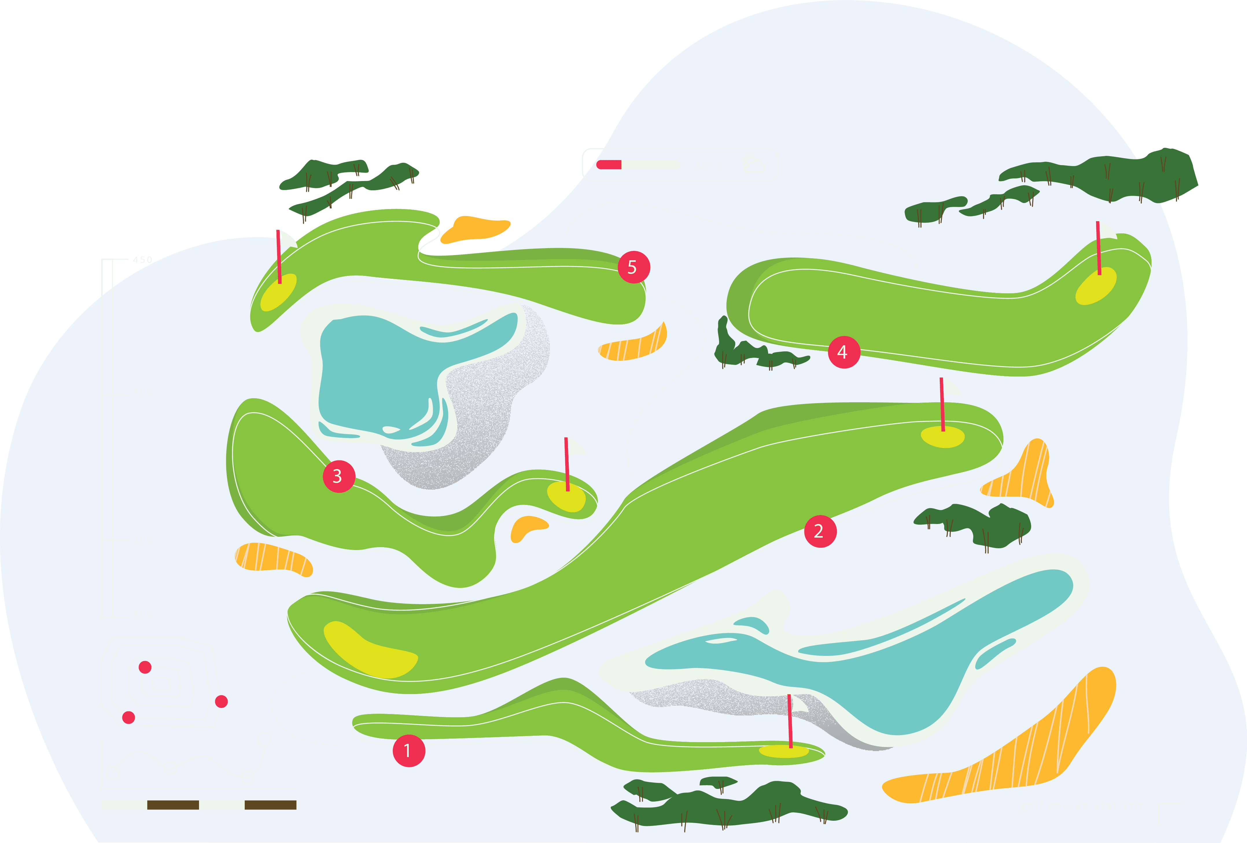
Golf Course Mapping in Google earth
DataEntryHelp is a leading provider of GPS mapping and GPS point location to a golf courses. It offers an efficient solution for mapping and digitization of a golf course to create the layout fairway, greens, tee boxes, water, sand traps, irrigation, yardage makers, cart paths etc.
We also provides golf course scorecard research and entry. We provides golf scorecard excel database for your high end mobile GPS app. We have successfully completed a project of golf scorecard entry for all US, Canada and Australia golf courses.
DataEntryHelp uses high end technology for GPS to make the golf course compatible with smartphones Android/iPhone/ Blackberry or iPod. We utilize the high-end technologies to gather a complete "data set" of a golf course.
The data set includes all the relevant information required for successful management and development of golf course as well as accurate course measurement data - area (in sq. ft.) of greens/fairways/tees, integrated sprinkler control system, irrigation and landscape planning, maintenance of greens, tees and fairways, total land of each specific hole distinguished by tees, fairways and greens, total acreage of Golf Course Property etc.
Along with the measurement, the data set bring benefits to course superintendent by minimizing grounds maintenance (i.e. fertilizer application) and irrigation costs.
The services are extremely beneficial to all individuals engaged in design, construction, development, and management of a golf course and the management of golf courses.
Markable points of a Hole:
- Front Green
- Back Green
- Center Green
- Hazards like sand traps/bridge/water
- 150/200 Yards
- T (Tess- the starting point)
Our Team Challenges:
- High Accurate Mapping
- Numbering Holes
- Finding Scorecards
- Mapping unclear holes in Google earth
- Defining hole number using Separate hole maps
- On time Delivery